• About

fivenineteen

~ My eclectic musings on reality…

fivenineteen

Tag Archives: foot trail

Lake Serene…Almost

02 Monday Sep 2013

Posted by fivenineteen in Uncategorized

≈ Leave a comment

Tags

exercise, foot trail, hike, Lake Serene, Mount Index, tired, views, waterfalls

WP_000471Yep, 80% Lake Serene.  I got schooled yesterday – got a big ol’ in-your-face reminder that I probably still have a White Belt in hiking.  Well, no, I’m not a total novice…right?  I don’t remember what the next belt level is up from that. Hmmmm.

J and I were sooooo excited to get a change of scenery and get in a hike on this holiday weekend! We’ve both been working so hard – weekends too sometimes.  And this is that time of year in the Seattle area where you hold on for dear life to summer and you cherish each and every single sunny day. Now, normally September (and even parts of October sort of) are dry and sunny, but starting today (Labor Day) the forecast for the rest of the week doesn’t look too good.

When we were talking about what to do I suddenly remembered a hike I did with a former co-worker about 10 or 11 years ago:  Lake Serene and Bridal Veil Falls.  So, that was our plan!  J had never been on that hike before and I told him how cool it is, because Lake Serene just suddenly pops up at the end of the trail.  I’ve never seen anything like it!  And it’s so worth it.  I told him how, yeah, there’s a bit of a climb at the end but the lake is stunning!

So, yesterday we hit the road and headed east on Highway 2.  We stopped for a late breakfast at a little café in Gold Bar.  And we’d packed some snacks for lunch and some water.  The turnoff for the trailhead is on Mount Index Road, about 7 miles east of Gold Bar, and it’s very clearly marked.  We were absolutely surprised to find a parking spot in the early afternoon, especially on a holiday weekend!

This hike is just over 7 miles round trip.  There’s a cool fork in the trail after a little ways where you can peel off for a half mile and go get up close with Bridal Veil Falls (and cool off!) or you can just stay on the main trail to Lake Serene, which was another two miles away.  We decided to just get to Lake Serene first.  And the trail does not disappoint.  Check out that pic up top of the gorgeous rock wall and falls trickling down.  I don’t know what kind of rock that is, but I just can’t get enough of that rich, charcoal grey color! We’re hiking up Mount Index here!

The first part of the trail climbs, but it’s mostly dirt with a few rocks and some muddy places and isn’t too difficult.  Once you cross the huge wooden bridge over the falls runoff it starts getting interesting.

As in ‘steep, rocky switchbacks’ interesting.WP_000468  Picture this shot at right but with a much steeper angle uphill.  That’s what the rest of the trek is up to the lake, and there are a few places where they put stairs in the trail.  In fact, it’s a 2000-foot elevation gain in about 3.5 miles!  YOW.  Lots of heavy breathing on this trail, including the adorable dogs we saw along the way.  And a couple of whining moaning kids too.  We were expecting it to be super crowded but amazingly it was not!  And the weather was perfect – 80 degrees and sunny.

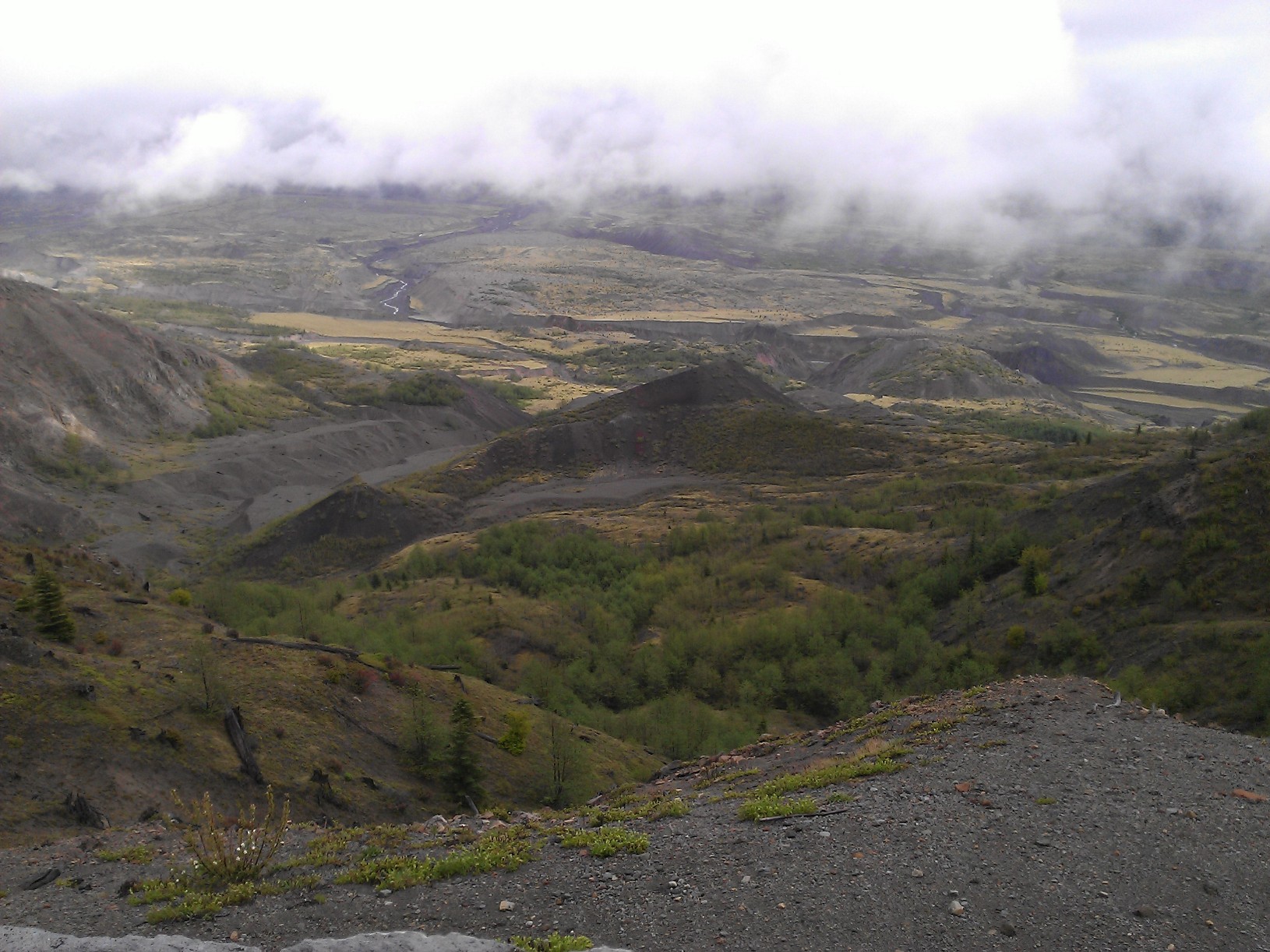
I took in the wonderful scenery all around.  The lush green moss on the trees – some trees tipped over, some reaching tall into the sky.  The craggy, rocky pointy peak of Mount Index and so many others jabbing into the sky and the steep drops down below.  The beautiful streams which are probably runoffs from glaciers much higher up.  I love the sounds of streams gurgling along.  It just sounds like…love.

After a few stops to catch our breath and gulp some water we asked people coming back down the trail how far we had to go.  “About an hour,” one couple told us.  OMG.  Another hour of rocky, steep seemingly endless switchbacks…going uphill.  The rocks are pretty stable so I never felt unsafe like I was going to trip and fall, but the incline is steep.  I pictured the stair climbing machine in the gym and can see where hours working out would make this hike a lot easier.

Then I started to feel a little woozy and light headed.  I’d been drinking enough water (I thought)…but I had that feeling just like when J and I went in the steamroom and saunas at the gym.  After the steam and sauna I felt faint and it took me awhile to get back to center.  Flash forward back to us catching our breath on the trail and I waited for that same lightheadedness to pass.  I’m glad I’d felt it once before so I didn’t panic.  I just breathed through it.  But then I wondered…if I’m already starting to feel a little out of it and we’ve got tons more rocky climbing ahead…am I really up for this?  I don’t do enough hiking to feel like taking big risks.  I didn’t want to get even more winded and risk getting injured if I was not feeling 100% and not able to pay close attention to each and every step I took up the rocks.  And we were going through our water a lot more quickly than we realized.   I’d brought a couple liters and J had an extra one already in his pack along with our food.  Hmmmm.  I told him how excited I was for us to see the lake and all…but also that it wouldn’t be the end of the world if we turned back.

So…he agreed and we did.  We knew going down the steep rocky trail would be hard on knees too, and I’m still not 100% healed from the fall I took at work in August.  I was relieved he wasn’t upset about turning back at all.  In fact, we talked about doing that hike again with better preparation.  Things like getting an earlier start in the day (we didn’t get on the trail until about 12:30pm), and bringing a lot more water and food.

I also might rethink what I wear.  I wore a sports bra, a tank top and a long-sleeved lightweight Dri-Fit mesh top over that…and my old J. Crew cotton shorts.  Dang I have a lot of synthetic workout/hiking clothing which is a much better choice than wearing cotton, but I can’t fit into a lot of it right now (not yet!).  And next time I’ll choose a more breathable baseball hat.  I’d doused myself both in sunscreen and in bug repellant because I’d read there were a lot of bugs on the trail.  How awesome…zero bug problems!  The bugs must have been from earlier in the year.  And the portion of the trail we did was mostly shady with some sunlight rippling through the trees, so I’ll ditch the long-sleeved top I brought for extra sun protection and just pack it along just in case.

Hiking boots are an absolute MUST on this trail.  Just sayin’.  What a relief my good ol’ Merrells with Gore-Tex are still trooping along.

And I had to laugh…I seriously blocked out how steep that climb was up to the lake!  And then I remembered…the last time I did that hike I was 11 years younger…and 40 lbs. lighter.

Lake Serene, we’re comin’ back!

Share this:

  • Twitter
  • Facebook

Like this:

Like Loading...

Birthday Road Trip to Mount St. Helens!

21 Tuesday May 2013

Posted by fivenineteen in Uncategorized

≈ 1 Comment

Tags

birthday, fog, foot trail, fun, hiking, Mount St. Helens, road trip

MtSTHWow, it’s been a couple of weeks since I last posted in here!  Everything is really busy and good these days…so much so I probably didn’t have a clue what to blog about last week.

So now…drum roll…last Sunday May 19 was my birthday (hence the name of this blog for those of you just tuning in), and I had THE most unique, wonderful and enjoyable celebration ever!  J and I were talking about our birthdays a few weeks ago (his is in early May) and about other things we’d like to do later in the year.  I mentioned how I’ve never been to Mount St. Helens and how happy I would be to have a chance to go check it out!  And we thought, why not do it on my birthday?  May 19 was one day after the 33rd anniversary of the big 1980 eruption.

I remember May 18, 1980 so well.  It was the day before my 13th birthday, and my family and I had spent the weekend down on the Washington Coast in Ocean Park, a longtime favorite getaway spot for us on the Long Beach peninsula.  It was a Sunday and we were driving home to the Seattle area.  By the time we got to Raymond on Highway 101, traffic was at a complete stop and backed up for miles.  What was going on?  It was Sunday in a rural area of the state – why so many cars?  Keep in mind, this was 1980 so we obviously didn’t have email, cell phones or other devices to keep us constantly updated with news. So, we turned on the radio and heard what happened.  The highway was jammed due to traffic detours. The mountain had erupted around 8:30am that morning.  Ash, rocks, mud and steam blasted miles up into the sky, and searing hot mudflows destroyed everything in their paths.  Interestingly enough, the blast was lateral, as the entire north face of the mountain pretty much gave way after being pounded relentlessly by earthquakes for months.  Millions of tons of ash blew eastward, so towns in central and eastern Washington were pitch black at high noon.

The mountain had reawakened earlier in 1980, smudging a near perfectly round snowy cap with an ash and steam blast, forming a new crater which continued to grow and grow.  The news coverage about this was fairly decent, but it was not a top story by any means and to many went simply unnoticed.  President Carter’s announcement of the Boycott of the summer Olympic games in Moscow was the big news.

Now before I get into more detail, you might be wondering…how the heck could we not know the eruption had occurred?  Didn’t we hear or see anything?  Was Seattle in any danger?  To answer these questions, you have to remember that Mount St. Helens is in a rural area of Washington State.  It’s about 100 miles south of Seattle and about a 3 hour drive from there by car.  As tragic as the devastation to homes, roads, bridges and wildlife was (not to mention 57 human casualties), the destruction would have been far worse near a more populated part of the state.  For many in the Seattle area, Mount St. Helens was mostly off our radar, except when it came time for spectacular camping and hiking, plus boating on nearby Spirit Lake.  I’m sorry I never had the chance to visit it before the eruption – it looked postcard perfect.

J and I hit the road on Sunday, ready to blast down I-5.  But first, we needed coffee!  J doesn’t like patronizing big chains like Starbucks and prefers going to smaller Ma and Pa type coffee shops, but once we got on the road they were few and far between.  We hopped off the freeway in Fife, hungry for caffeine.  Fife is one of those places I’ve always blasted through on my way somewhere else, so it was interesting seeing what the town looks like.  Actually, not really.

We ended up going through a Starbucks drive thru…and when we got back on the road J discovered his double tall latte was actually hot water with 3 honeys in it.  Oops, they screwed up our order!  We laughed it off and sipped “honey water” the whole way down.  Meanwhile, I’m sure some poor soul was lamenting about getting a latte instead of their hot water and honey!

Then, we needed breakfast.  We stopped in Lacey, not far from Olympia.  J remembered a wonderful hole in the wall diner he really liked somewhere off the highway, but we couldn’t find it.  Our hungry stomachs won out and we headed into the Hawks Prairie Casino.  We weren’t thrilled with the idea of eating breakfast in a smoky environment (smoking is permitted in casinos as they are on Native American land and exempt from state no-smoking regulations), so we were pleasantly surprised that the restaurant was smoke free.  Scrambled eggs, hashbrowns and lots of coffee!

We still had a way to go.  Mount St. Helens is a good 50 miles or so east of I-5, after about a 2 hour drive south, so at minimum it’s a day trip from Seattle.  We were headed to the Johnston Ridge Observatory, just 5 miles from the crater.  The picture at the top of this post is the view we were waiting for!

Once we got off of I-5 and onto the two-lane highway headed east, it started getting interesting.  Rural little towns and lots of forest.  Places I’ve never driven through even after living in Washington State my whole life.  I was so excited I could hardly stand it!  Road trips make me giddy.  Then we turned onto the Spirit Lake Highway, the last stretch of the trip.  Cell phone signals went dead and we started climbing in elevation.  The observatory is 4300′ up! Even the GPS didn’t have much to say.  Then…FOG. Lots of it.  We were driving through a thick cotton ball for probably a good half an hour.  On a winding rural road headed up a mountain…let’s just say this gets your adrenaline flowing.  We would zoom over bridges with no idea of what scenery we were missing or how high up the bridge was.  I tried not to let my mind wander about that too much.

9_000298When we arrived at Johnston Ridge and pulled into the parking lot, this was the view.  The fog was so thick we felt discombobulated getting out of the car.  And notice the snow!  Silly me, I was a little surprised to see snow in mid May, but then again we’re up in the mountains!  I couldn’t even see the other side of the parking lot, nor could I see where the observatory entrance was.  I ended up asking the lady running a small concession stand out of a trailer in the lot where the entrance was – that’s how thick the fog was!

We were ready to check out the observatory and get in some hiking.  There are quite a few trails with various levels of difficulty all around, and the views of the mountain are amazing.  Although on Sunday we really had to use our imagination.  The view from the observatory was nothing like the picture at the top of this post.  Rather, it was just WHITE.  FOG.  Nothing.  I was joking that you could take your picture with the whiteness behind you and then photoshop a picture of the mountain or anything else of your choice behind you later!

The observatory is run by the US Forest Service, and the guys are wonderful.  Very helpful and friendly.  They said they get about 300,000 visitors annually, from all over the world.  Wow!

Once you are inside you can check out interactive displays of the volcano, watch a couple of movies and see tons of before and after pictures.  This is all included in your $8 entrance fee; you’ll get a wrist band just like you’re in a nightclub. I joked that I should be able to get in free because it’s my birthday, but of course no such luck.  Besides, the fees help cover costs of keeping the place open.

We went to a Ranger talk, and I highly recommend doing this.  He was super enthusiastic and passionate, talking about the volcano and showing various pictures and answering questions.  J and I even talked with him for about a half hour afterwards!

Then we were ready to get outside on the trails!  The trails leaving the observatory are asphalt paved so it’s very easy to get around. Once you get further away the paving stops.  Sadly, we never got that far.  4_000292We checked out the short trail headed up from the building which overlooks the parking lot.  Short with switchbacks…and hardly anything to see except for the building below.  Off to the left is a spectacular valley and the view of the mountain, which would normally dominate the skyline.  Would Mother Nature lift the fog?  Only time would tell.  Some people we talked to had been hanging out since early in the morning waiting for it to clear up.

5_000293This entire area is extremely fragile, as the ecosystem is slowly rebuilding, and the goal is to have minimal to no human interference with what nature is doing.  What a treasure this volcanic monument and national forest is!  That’s why the regulations for visitors are strict, and it’s important to do your homework and prepare ahead of time to avoid problems.

For example, pets are not permitted on the trails or anywhere in the observatory.  Make arrangements for them to be cared for at home.  You’ll also want to bring your own food and plenty of water.  There are no restaurants or vending machines at Johnston Ridge.  (Also, no food is permitted inside the observatory).  J and I had lunch in the parking lot, enjoying wonderful BBQ’d chicken he had prepared the night before.  Killer marinade!

You also need to stay on the trails.  This is not only for safety but also to avoid treading on nature’s rebuilding processes. “Plants grow by the inch and die by the foot” say the warning signs.  Also, don’t touch or try to take home rocks as souvenirs.  You’ll be heavily fined.

We headed downhill on the paved trail into the valley…but after just about 1/4 of a mile we had to turn back.  SNOW blocked the trail at a steep, sloped angle, leading to a 1000′ drop off down into the foggy valley.  No thanks!  But it made us long for next time…we learned how the valley floor is filled with wildflowers and shrubs in the summer time.  The valley was once old timber forest – flattened or swept away in the blast within seconds.

Around 4:30pm we decided to head back to make sure we were heading home in daylight.  Sure enough, the fog started lifting!  Just enough of a tease to see the valley, not the mountain herself.

The picture below is one of my favorites from this trip.  This was taken from a lookout a short drive downhill from the observatory looking down into the valley.  You can see the start of the Toutle River just to the left of center.  This entire area looked like the moon after the eruption, and it’s astonishing how much wildlife and plants are slowly returning.

The mountain is hiding behind the thick clouds, tempting us for our next visit.

16_000307

Share this:

  • Twitter
  • Facebook

Like this:

Like Loading...

Beat the Bridge…Beaten

15 Sunday May 2011

Posted by fivenineteen in Uncategorized

≈ 1 Comment

Tags

bridge, float, foot trail, freeway, friends, JDRF, jewelry, pinot grigio, real housewives, run, sleep, tired

Ah, bridges.

How much we depend upon our beloved bridges around here in the beautiful Puget Sound region.  Pulsing arteries jampacked with cars, buses, bikes – and painfully clogged during those peak commuter hours.  We’ve got so much natural gorgeousness around us…lakes, the Sound (salt water), rivers, mountains – all within a short drive for most of us.  Meaning, you can’t go far without eventually running into one of those.

Today was the annual Beat the Bridge run/walk to benefit the Juvenile Diabetes Research Foundation.  The jewelry line I represent, Silpada Designs, has JDRF as its charity of choice.  One of the girls on our local team here had a wonderful idea for us to do Beat the Bridge and pledge to donate the commission from one of our jewelry parties as part of our fundraising!  What a great idea! With 10 of us participating and an average party commission at around $300 (yes, it’s true) we were excited to set our team goal at $3000!  Which bridge you may wonder?  The University Bridge, not far from the U of W campus where the race starts and finishes. 

This was planned back in February. And yes, we had the best of intentions.  However, the Universe had other intentions, which I discovered around 6am this morning.  

Bottom line, we didn’t go.  Damn that pouring rain already!

I knew that I’d be walking most if not all of this 8K – and most of the other girls were planning to as well.  Back in February I figured this would be a great way to kickstart getting back in shape for this summer’s 5Ks by restarting the Couch to 5K plan I’ve written about in here occasionally over the past year.  It’s an 8-week running and walking program – just 3 times a week – that gets you ready to run a 5K when you’re done.  And yes, it works!

But illness and stress earlier this year really sapped my energy and my poor lungs.  I had a bad cold and cough for about two months – it just wouldn’t go away.  It was all I could do to eeek out a game of hockey, much less hit the treadmill or go outside in our (cold, shitty) winter weather.  Soggy, soggy soggy.

Nevertheless, I was ready to get out of bed super early and drive to the freeway bus stop where my carpool was going to scoop me up this morning on the way into Seattle.

But let me back up to Saturday for a minute…a glorious, sensuous, warm and sunny day – the kind of day we’ve been starving for here all spring.  Spring so far this year has been a repeat of our rain-soaked, chilly winter sans the snow.  I had a few things planned for Saturday but decided to squeeze in another mini-adventure when it dawned on me that I really should verify I know how to get to the freeway bus stop where my carpool was going to pick me up.  I had an idea in my mind of how to get there, but realized it had been – gasp – nearly 10 years since I’d ventured to that bus stop with a friend.  I’d better go drive over and check it out!  And it was a beautiful day – a perfect excuse to open the sun roof and get some vitamin D the natural way, crank some music and just drive.

So what’s the big deal about this bus stop?  Well, it’s perched literally at land’s end before the freeway turns into one of our two floating bridges that connect Seattle with the suburbs.  These bridges were built decades ago and at the time were very state of the art given they ‘float.’  Lake Washington was determined too deep to do any sort of structural building underneath, hence the floating design.  And I’ll keep it to that because I’m no expert in structural engineering.

Now, there is an oddly creepy-looking pedestrian bridge over the freeway on the east side of the lake, which is how my friend P and I last got to that bus stop nearly a decade ago.  P and I have fallen out of contact and I’d forgotten where we had parked to walk across that bridge, hence my sunny journey in the car yesterday.

Boy am I glad I checked it all out.  There are major projects underway to build a second portion of this particular floating bridge to help with congestion…and, as I soon found out, plans to remove that pedestrian bridge!  Yep, once I figured out where to park and found the foot trail that was supposed to get me to the pedestrian overpass it was all blocked off.  Wow.

So it was a neon yellow vinyl fence that stopped me from my foot journey over the freeway.  And I was not one to rebel and climb through.  Who knows – it might not be structurally sound any longer.  Actually that’s not a good feeling since thousands of cars drive under it every day, but anyway I wasn’t going to chance it.

But I looked across the freeway and could see people waiting at that elusive bus stop.  How the hell did they get over there?  There was no parking lot near it at all – just a carved out covered area in a small, grassy hillside to stand or sit. 

As I started to get a little frustrated (NOW what?) I paused for a moment and just drank in everything around me.  I’m standing on a dirt trail in beautiful sunshine.  I’m mere steps from incredibly ritzy homes (in the ‘high rent district’ neighborhood around here called Medina).  And I’m also mere steps from, well, a 20 foot drop down to a roaring river freeway, with the hillside below covered in tangled, dirty weeds from decades of car exhaust.  How rare is it we stand still so close to a freeway like this?  Thankfully my time roadside has been those rare occasions when I’ve been in a fender-bender or have a flat tire.  It’s just astonishing watching and hearing the amount of cars whizzing by every second and being so close perched at the angle above it on the foot trail.  I think back on how many thousands of times in my life I have gone back and forth over that bridge.  As a child in the back seat of my parents’ old station wagon.  On my own as a teen and a freshly-minted drivers license in an orange 1970 Volvo (LOVED that car, wow). And countless times as an adult.

I jumped back in my car and drove back to the main road.  Aha!  I found a small, gravelly parking lot for bus commuters.  The trick was to park there and walk over the main road that goes over the freeway, not the pedestrian bridge.  Then, jump onto the trail on the bus stop side and voila – you’re there!  Wow, cryptic.  Believe me I tried searching online for maps long before I got in the car.  Anyway, a little resourcefulness pays off.

I walked over the freeway, again in awe of the cars whooshing by below me.  And looked to the west toward our beautiful, shining Lake Washington and the Olympic Mountains a little hazy along the horizon.  This is our back yard.  And how awesome it was to take it in on foot rather than as a stressed out commuter.  As I stepped onto the foot trail down to the bus stop I ran into a very nice lady out walking her dog.  She was disappointed that the pedestrian bridge was now closed off – she sounded like she walked over it fairly often so this might have been a really recent closure.

After my bridge and freeway adventure I drove over to my friend M’s house.  Back in the car, I laughed to myself and thought WOW, I am SO GLAD I did all that foot trail and bus stop homework a day ahead of time.  I am a terrible morning person and I would have been a total zombie case trying to figure it out that morning, worrying my carpool would be held up. 

After a quick visit with M (she is going to host a jewelry party in combination with her new office opening and we’re so excited!), I headed back home, grabbed a bottle of pinot grigio and walked up to my neighbor A’s house.  We’re getting in a groove of watching any of The Real Housewives series (on Bravo) that she has in her Tivo a couple of times a month.  Sadly I have not yet made the switch to flat screen TV but that’s another post.  If any of you follow the New York housewives, you’ll understand the pinot grigio (it’s the signature drink of one of the cast). 

So after getting caught up with A and laughing our asses off at fabulous trainwreck TV, I headed home to carbo load with some penne and pesto and forced myself to bed early.  I knew I had to leave the house around 6am to get to that good ol’ bus stop for my carpool.

And, it started to rain.  What a huge contrast from the tease of sunny spring we had earlier in the day.  I kept optimistic – the weather forcecast for Sunday was a ‘chance of showers.’  Actually, around here you could use that forecast every day and be pretty accurate.

I was tired this morning.  But I got out of bed, got dressed in my walking/running gear and after scaring myself looking in the mirror I dabbed on a small bit of foundation (my face is naturally ruddy so anything to tone it down helps) and a little flick of mascara for those tired eyes.  Keys, hat, sunglasses (I’m eternally optimistic plus sensitive to glare)…and…phone.

Wow.  My phone had blown up with tons of voicemail and texts last night after I’d forced myself to go to bed early, but I didn’t see any of it until early this morning.  I keep my phone downstairs at night because I don’t feel a need to have it with me 24/7.  

When I saw how my carpool driver plus a ton of others in the group were going to cancel, the wind went out of my sails.  Just poof and pffffttt.  Why cancel?  Rain. Yep, it was still raining hard this morning and even still is now in the early afternoon.

So I was a sheep and I bailed too.  I felt a little dejected because I was looking forward to trying this race for the first time with friends, but I have to know that it just wasn’t meant to be.  And I won’t dig too deep for the reason right now.

‘Cause I’m tired.    

Share this:

  • Twitter
  • Facebook

Like this:

Like Loading...

Enter your email address to follow this blog and receive notifications of new posts by email.

Join 119 other followers

Recent Posts

  • …and the World got Sucker Punched
  • tap tap tap…is this thing still on?
  • First Soup of 2016! Red Lentil and North African Spices
  • Break on Through to the Other Side…
  • Dreams…Dusted Off

4 agreements birthday bliss book ceiling change changes cookbook cooking drama dreams emotions energy equinox exercise family fitness food food processor friends friendship gluten free gym happiness health hiking hockey home projects ingredients intuitive eating jewelry job joy laptop lean eating love MAC makeup man help memories music networking new year nutrition paint passion precision nutrition preparation projects recipe relationships Seattle shopping Silpada sleep slow cooking soup South America spices stress sunshine time tired Tom Douglas townhouse transformation travel vegan walk walking weather weekend work workout workshop

Categories

  • Uncategorized

Blogroll

  • 32 Dreams
  • A Lot on Your Plate
  • Alaskagirlatheart
  • Amaryllis sillyramA
  • Belle Grove
  • Bucket List
  • Everywhere Once
  • Going Dutch
  • Lady Romp
  • Maggie's One Butt Kitchen
  • Makeup by Tiffany D
  • Makeup Geek
  • Moment Matters
  • Rogue Wave Media
  • Sybaritica
  • The Ranting Chef
  • The Walk & Talk

Archives

Blog Stats

  • 22,330 hits

Search fivenineteen

Meta

  • Register
  • Log in
  • Entries feed
  • Comments feed
  • WordPress.com

Twitter Updates

  • Put me on the cover of Men's Health! I Need your vote! orm.la/xzKR 6 years ago
  • Go #Seahawks! #WhosGonnaWin vz.to/1gjdi5E @VerizonWireless 6 years ago
  • Go #Seahawks! #WhosGonnaWin vz.to/1gjdi5E @VerizonWireless 6 years ago
  • Love me some @RSherman_25 . That is all. 7 years ago
  • Interval training today @insidePN ...rocked! 7 years ago
Follow @five19

Blog at WordPress.com.

Cancel
Privacy & Cookies: This site uses cookies. By continuing to use this website, you agree to their use.
To find out more, including how to control cookies, see here: Cookie Policy
%d bloggers like this: